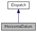
A way to convert a geographical position between a local horizontal datum and WGS84. More...
import"encxcom.idl";

Public Member Functions | |
| HRESULT | LocalToWGS84 ([out] DOUBLE *LatWGS84, [out] DOUBLE *LonWGS84, [in] DOUBLE LatLocal, [in] DOUBLE LonLocal, [out, retval] VARIANT_BOOL *bRes) |
| Convert a geographical position on the local datum to WGS84. More... | |
| HRESULT | WGS84ToLocal ([out] DOUBLE *LatLocal, [out] DOUBLE *LonLocal, [in] DOUBLE LatWGS84, [in] DOUBLE LonWGS84, [out, retval] VARIANT_BOOL *bRes) |
| Convert a geographical position on WGS84 to the local datum. More... | |
Properties | |
| DOUBLE | ErrorDistanceMetres [get] |
| The accuracy of the transformation. Units are metres. More... | |
| VARIANT_BOOL | HasLocalDatum [get] |
| Returns true if the chart has a local datum which is not WGS84. More... | |
| BSTR | LocalDatumShortName [get] |
| The local datum name in either long or short form. See HCRF 2.0 A.4 HORIZONTAL DATUM CODES. More... | |
| BSTR | LocalDatumLongName [get] |
| The local datum name in either long or short form. See HCRF 2.0 A.4 HORIZONTAL DATUM CODES. More... | |
Detailed Description
A way to convert a geographical position between a local horizontal datum and WGS84.
A horizontal datum may be provided for each panel on a raster chart.
Definition at line 865 of file encxcom.idl.
Member Function Documentation
◆ LocalToWGS84()
| HRESULT IHorizontalDatum::LocalToWGS84 | ( | [out] DOUBLE * | LatWGS84, |
| [out] DOUBLE * | LonWGS84, | ||
| [in] DOUBLE | LatLocal, | ||
| [in] DOUBLE | LonLocal, | ||
| [out, retval] VARIANT_BOOL * | bRes | ||
| ) |
Convert a geographical position on the local datum to WGS84.
Returns false if the position is outside the area of the datum - the conversion will still be performed but will be less accurate.
◆ WGS84ToLocal()
| HRESULT IHorizontalDatum::WGS84ToLocal | ( | [out] DOUBLE * | LatLocal, |
| [out] DOUBLE * | LonLocal, | ||
| [in] DOUBLE | LatWGS84, | ||
| [in] DOUBLE | LonWGS84, | ||
| [out, retval] VARIANT_BOOL * | bRes | ||
| ) |
Convert a geographical position on WGS84 to the local datum.
Returns false if the position is outside the area of the datum - the conversion will still be performed but will be less accurate.
Property Documentation
◆ ErrorDistanceMetres
|
get |
The accuracy of the transformation. Units are metres.
◆ HasLocalDatum
|
getproperty |
Returns true if the chart has a local datum which is not WGS84.
Some ARCS charts use a local datum other than WGS84. ARCS polynomials support non-linear datum shifts (see Admiralty List of Radio Signals Volume 8 NP288 for an explanation).
Raster charts which do not have accurate WGS84 transformation polynomials behave as charts with a local datum. In this case the offset (between local and WGS84) is linear and determined by CRasPanelInfo::ManualWGS84Shift(). The default is zero.
Typically local datum conversions are only needed when dealing with external position information which is in the same local datum as the chart.
◆ LocalDatumLongName
|
get |
The local datum name in either long or short form. See HCRF 2.0 A.4 HORIZONTAL DATUM CODES.
◆ LocalDatumShortName
|
get |
The local datum name in either long or short form. See HCRF 2.0 A.4 HORIZONTAL DATUM CODES.